


Dracut Precinct 4, Middlesex County, Massachusetts
About
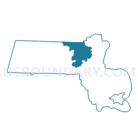
Outline

Summary
| Unique Area Identifier | 594602 |
| Name | Dracut Precinct 4 |
| County | Middlesex County |
| State | Massachusetts |
| Area (square miles) | 6.90 |
| Land Area (square miles) | 6.61 |
| Water Area (square miles) | 0.29 |
| % of Land Area | 95.74 |
| % of Water Area | 4.26 |
| Latitude of the Internal Point | 42.69355200 |
| Longtitude of the Internal Point | -71.25661010 |
Maps


Graphs
Select a template below for downloading or customizing gragh for Dracut Precinct 4, Middlesex County, Massachusetts


Neighbors
Neighoring Voting District (by Name) Neighboring Voting District on the Map
- Andover Precinct 5, Essex County, MA
- Dracut Precinct 7, Middlesex County, MA
- Dracut Precinct 8, Middlesex County, MA
- Methuen Precinct 11, Essex County, MA
- Methuen Precinct 8, Essex County, MA
- Tewksbury Precinct 3, Middlesex County, MA
- TOWN OF PELHAM Voting District, Hillsborough County, NH
Top 10 Neighboring County Subdivision (by Population) Neighboring County Subdivision on the Map
- Methuen Town city, Essex County, MA (47,255)
- Andover town, Essex County, MA (33,201)
- Dracut town, Middlesex County, MA (29,457)
- Tewksbury town, Middlesex County, MA (28,961)
- Pelham town, Hillsborough County, NH (12,897)
Top 10 Neighboring Place (by Population) Neighboring Place on the Map
Top 10 Neighboring Unified School District (by Population) Neighboring Unified School District on the Map
- Methuen School District, MA (47,255)
- Andover School District, MA (33,201)
- Dracut School District, MA (29,457)
- Tewksbury School District, MA (28,961)
- Pelham School District, NH (12,897)
Top 10 Neighboring State Legislative District Lower Chamber (by Population) Neighboring State Legislative District Lower Chamber on the Map
- State House District 27, Hillsborough County, NH (45,635)
- Fifteenth Essex District, MA (43,123)
- Seventeenth Essex District, MA (42,166)
- Thirty-Sixth Middlesex District, MA (40,749)
Top 10 Neighboring State Legislative District Upper Chamber (by Population) Neighboring State Legislative District Upper Chamber on the Map
- First Essex District, MA (170,805)
- Second Essex & Middlesex District, MA (167,996)
- State Senate District 22, NH (56,033)
Top 10 Neighboring 111th Congressional District (by Population) Neighboring 111th Congressional District on the Map
Top 10 Neighboring Census Tract (by Population) Neighboring Census Tract on the Map
- Census Tract 3143.01, Middlesex County, MA (8,011)
- Census Tract 2544.02, Essex County, MA (6,713)
- Census Tract 3151, Middlesex County, MA (5,456)
- Census Tract 2003, Hillsborough County, NH (4,283)
- Census Tract 2521.02, Essex County, MA (3,798)
- Census Tract 2522.02, Essex County, MA (3,198)
- Census Tract 3143.02, Middlesex County, MA (2,935)